
Leitir Moir [Lettermore Island]
Good walks are even better shared.
Overview
Leitir Moir [Lettermore Island]
Leitir Moir, the grand hillock of Lettermore Island, rises gracefully to an elevation of 261 meters. It stands out not just for its height, but for its impressive views of the Connemara coastline and the dramatic Atlantic Ocean. Known as a Marilyn, it attracts hikers seeking both beauty and a touch of adventure.
Geology
Formed primarily of schist and granite, these rocks are remnants of the geological history that shaped the landscape of Connemara. - perfect for those who fancy a bit of geology with their hiking!
Hiking Routes
The Seaward Approach is a popular trail that starts just off the main road to Lettermore. Covering a distance of about 3.5 km, it's a moderate hike that's perfect for most fitness levels. This route takes you through picturesque heaths and allows for some stunning views of the coastline.
Summit Features
Reaching the summit, you'll be greeted by a modest stone cairn, and if the weather’s on your side (no promises!), the panoramic views will leave you breathless - in the best way!
Terrain
Prepare for a mix of rocky outcrops and grassy knolls, with the occasional boggy patch to keep you on your toes. This can make for a bit of a hike, but worry not; the stunning landscapes are well worth it!
Scenic Highlights
From the top, you can feast your eyes on the Atlantic Ocean's vastness and the sight of Inis Meain, alongside the jagged profiles of the Twelve Bens. Just remember, the best times for these views are during the spring and autumn when the skies are clear and the scenery appears in all its glory.
Hazards
Stay alert for sudden weather changes! One minute you're basking in the sun, the next you might find yourself dodging raindrops. Also, the rocks can be slippery, especially when wet, so mind your footing!
Nearby Summits
Don’t miss the nearby Mullaghmore, which towers at 427 meters and offers its own set of challenges and rewards.
Access and Facilities
Access is relatively simple - park at An Ceann Mor, a stone's throw from the trailhead. Busy people can catch a bus to Barna, but might need a taxi to get closer. Around Lettermore Island Village, you can find some delightful places to refuel with a hot drink, though facilities on the island are not abundant.
History
The name Leitir Moir literally means ‘big hillside’ in Irish, which is both charming and descriptive! The area is steeped in folklore and cultural significance, resonating with stories from centuries past.
In closing, Leitir Moir offers a convivial hike and a great day out for those yearning to connect with nature. Just remember to check the weather before you head out – the only thing worse than a mountain without a view is a soggy sandwich!
Happy hiking!
Explore routes near Leitir Moir [Lettermore Island]
Public walks starting within 80 km of this hill. Nearby does not mean a route reaches the summit; check its map and access before setting out.
No public routes are currently listed within 80 km of Leitir Moir [Lettermore Island] on Walkmates. This does not mean there are no paths here. Explore the map and check local access information before planning a walk.
Route planning notes
These notes describe possible approaches, not verified navigable routes or permission to cross land. Check current paths, local access rules and conditions before setting out.
Seaward Approach
A scenic route that meanders through coastal heaths and overlooks the Atlantic Ocean.
Make a day of it, together
Find someone to share the walk with, or organise a day out along a route you like.
Hill facts and local notes
Classifications
Elevation
117m
384 ft
Prominence
117m
Coordinates
53.2960, -9.6636
L891285
OS Map
44
At the Summit
The summit features a small stone cairn and a spectacular view of the surrounding islands and sea.
Terrain & Geology
The mountain is primarily composed of schist and granite, which forms a rugged landscape typical of this coastal area.
Views & Scenery
Incredible vistas of the Atlantic Ocean, Inis Meain, and the Twelve Bens mountain range.
History & Heritage
Name Origin
Leitir Moir translates to 'big hillside' in Irish, aptly describing its prominent stature.
Historical Significance
The area is rich in cultural history, with links to ancient Celtic traditions and local legends.
Getting There & Facilities
Check current local access restrictions, parking rules and transport timetables before travelling. These notes do not confirm public access to the summit.
Parking
Free parking is available at An Ceann Mor, with a short walk to the trailhead.
Public Transport
Daily buses run from Galway City to Barna, but a taxi may be required from Barna to the trailhead.
Nearby Facilities
There are no facilities directly on Lettermore Island, but nearby Barna offers cafes and public toilets.
Safety Information
Known Hazards
- Watch out for sudden weather changes and slippery rocks, particularly when damp.
General Safety Tips
- Check weather conditions before setting out
- Carry appropriate clothing and equipment
- Let someone know your planned route
- Take a map, compass, and GPS device
- Carry emergency supplies: food, water, first aid kit, torch
Hills
Some common questions about the hills answered
Are there group walks up Leitir Moir [Lettermore Island]?
Many walkers use Walkmates to join or organise walks with others. You can check for group walks around Leitir Moir [Lettermore Island] through the maps
Are there other walkers around Leitir Moir [Lettermore Island]?
Activity varies by location and time, but Walkmates lets you see whether others have shared walks or shown interest in this area. Find other people through the walking friends search walking friends for Leitir Moir [Lettermore Island] search or of course create your own walk for Leitir Moir [Lettermore Island]
Can I organise a walk to Leitir Moir [Lettermore Island]?
Yes. If there aren’t any walks listed already, you can create a walk and make it available for others to join.
If you're signed up to Walkmates, you can create a walk to Leitir Moir [Lettermore Island].
How do I find a walk up this hill?
There are often multiple ways to walk this hill, depending on experience and route preference. Walkmates helps you explore walks and routes that others have shared.
Can I suggest a new route up Leitir Moir [Lettermore Island]?
Yes. You can suggest or create routes to share with others. Walkmates focuses on the social side of walking, so routes are used to help people organise walks and explore areas together, rather than as detailed navigation tools or route libraries.
Other uses really appreciate knowledgeable walkers sharing their routes. Share your favourite route to Leitir Moir [Lettermore Island] here
The is an error or something incorrect about this hill. How do I let you know?
We always strive to keep the information on Walkmates as accurate as possible. If you find an error, please let us know through the contact form and we'll aim to correct it as quickly as possible
Community Discussion
Comments
Location
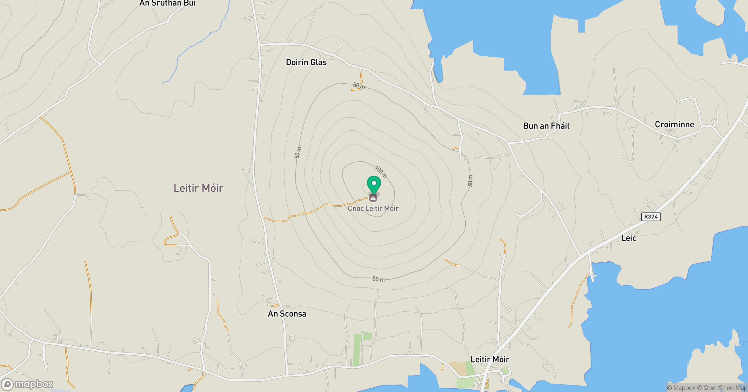
Grid reference: L891285
View on OpenStreetMapOpens a map in a new tab, centred on the hill.
Hills within 30 km
Straight-line distance, not a walking route or confirmation of access.
No comments yet. Be the first.